skip to main |
skip to sidebar
Standardized Choropleth Maps
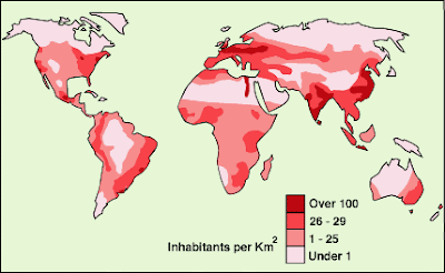
Standardized choropleth maps are standardized to show comparisons of distribution among different areas. The above map is a standardized choropleth map of the United States Population Density.


No comments:
Post a Comment